
In the ever-evolving world of technological innovation, LiDAR Technology has emerged as a breakthrough tool for understanding the physical world with extreme precision. An acronym for Light Detection and Ranging, LiDAR uses laser light to generate detailed, high-resolution 3D representations of surrounding environments. It’s reshaping industries like transportation, archaeology, construction, and environmental monitoring by enabling measurement and mapping tasks that were previously slow, expensive, or impossible.
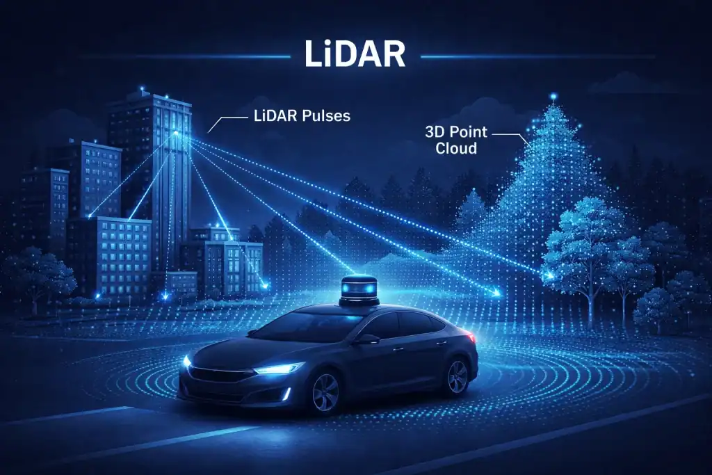
In autonomous driving, LiDAR Technology plays a practical role: it helps vehicles “see” depth, distance, and object boundaries in a way that complements cameras and radar. Cameras capture texture and color, radar performs well for speed detection and long-range sensing, and LiDAR adds accurate spatial geometry—especially useful for identifying obstacles, curbs, and lane edges. This multi-sensor approach improves confidence in complex scenarios such as merging traffic, night driving, or navigating cluttered urban streets. As costs fall and sensors shrink, LiDAR is also expanding beyond premium vehicles into robotics, delivery systems, and smart infrastructure.
What is LiDAR Technology?
LiDAR Technology is a remote sensing method that uses pulsed laser light to measure distances to the Earth or nearby objects. These pulses, combined with precise timing and positional data, produce three-dimensional information about surfaces—capturing shape, orientation, and sometimes reflectivity. It’s often described as 3D laser scanning and is widely used in mapping, surveying, and navigation.
You may also see it referenced as laser altimetry or laser imaging detection and ranging, especially in geospatial applications. Compared with photogrammetry (which reconstructs depth from images), LiDAR can produce highly accurate point clouds even when surfaces lack visual texture, and it can sometimes “see” through gaps in vegetation to estimate ground elevation. For autonomous systems, that accuracy can support cleaner localization, better obstacle separation, and more stable perception when lighting conditions change.
Breaking down LiDAR Technology
LiDAR systems emit thousands (sometimes millions) of laser pulses per second toward a target. When pulses strike an object, they reflect back, and the system measures the time-of-flight to compute distance. Repeating this rapidly across many angles creates a dense 3D point cloud—essentially a geometric model of the environment.
Key components of a LiDAR system include:
- Laser: Emits short pulses of light.
- Scanner: Steers the beam across the target area.
- GPS/IMU: Provides location and orientation for accurate mapping (common in mobile/airborne setups).
- Photodetector: Captures the reflected light and measures return timing.
In forestry, LiDAR can estimate canopy height, understory density, and even terrain under trees—supporting conservation and risk modeling (like landslides or fire behavior). In urban planning, it helps generate digital elevation models for drainage design, road grading, and floodplain assessment. In vehicle perception, LiDAR returns can support object contours and free-space detection—helping an autonomous stack differentiate a bicycle from a signpost, or a curb from a shadow.
Origins or History of LiDAR Technology
| Era | Milestone in LiDAR Development |
|---|---|
| 1960s | First conceptualized alongside laser technology development |
| 1970s | Early adoption in meteorology for atmospheric measurements |
| 1980s | Integration into geospatial applications for mapping and surveying |
| 1990s | Miniaturization and increased use in defense and environmental monitoring |
| 2000s–Present | Rapid adoption in autonomous vehicles, drones, and consumer technologies |
LiDAR’s growth closely follows improvements in lasers, sensors, and computing. As processing power increased, point clouds became easier to handle and visualize, accelerating adoption in mapping and automation. More recently, competition in mobility and robotics has pushed manufacturers to reduce size, increase resolution, and improve reliability—key drivers behind today’s LiDAR momentum.
Types of LiDAR Technology
LiDAR technology can be broadly classified into two types based on its application:
| Type | Description |
|---|---|
| Airborne LiDAR | Mounted on aircraft, this type is ideal for mapping large areas, including forests, coastlines, and cities. |
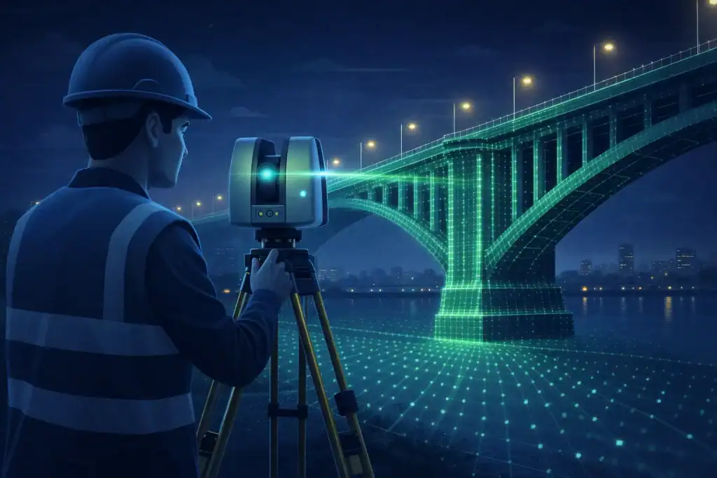
| Terrestrial LiDAR | Ground-based systems used for surveying infrastructure, archaeological sites, and roadways. |
It can also be grouped by wavelength:
- Topographic LiDAR: Typically near-infrared for land mapping.
- Bathymetric LiDAR: Often green lasers to measure underwater surfaces (useful for coastlines and shallow waters).
In autonomy, another helpful distinction is mechanical vs. solid-state designs. Mechanical units often rotate to capture a wide field of view, while solid-state approaches aim to reduce moving parts for durability, lower cost, and easier vehicle integration.
How Does LiDAR Technology Work?
LiDAR systems operate using three key processes:
- Emission of Pulsed Light: The laser emits short, rapid bursts of light.
- Reflection and Detection: The light hits objects and reflects back to the sensor.
- Data Processing: Distance and angle data are processed to create a 3D map.
For example, self-driving cars use LiDAR to continuously scan their surroundings, identifying obstacles and calculating safe navigation paths.
Pros and Cons
Table: Pros and Cons of LiDAR Technology
| Pros | Cons |
|---|---|
| High Accuracy | High Initial Cost |
| Real-time Data Acquisition | Limited Performance in Poor Weather |
| Versatile Across Industries | Requires Skilled Operators |
| Penetrates Dense Vegetation | Data Storage and Processing Requirements |
While LiDAR offers unmatched precision and versatility, its drawbacks, such as high costs and sensitivity to environmental conditions, must be considered.
Companies Leading the LiDAR Revolution
Numerous companies are spearheading advancements in LiDAR technology. Notable names include:
- Velodyne LiDAR: Pioneering automotive LiDAR systems.
- Leica Geosystems: Known for its advanced surveying solutions.
- Quanergy Systems: Specializes in smart LiDAR sensors for industrial automation.
- LeddarTech: Develops LiDAR systems for autonomous vehicles.
Applications or Uses
LiDAR technology finds application across a multitude of industries:
Urban Planning and Infrastructure Development
In city planning, LiDAR maps topographies to assist in building design, road construction, and floodplain analysis.
Forestry and Environmental Conservation
LiDAR measures tree canopies, calculates biomass, and monitors deforestation, aiding in sustainable resource management.
Autonomous Vehicles
LiDAR forms the “eyes” of self-driving cars, enabling real-time detection of obstacles, lane markings, and pedestrians.
Archaeology
This technology unveils hidden landscapes and buried structures without disturbing sites.
Conclusion
LiDAR technology has transformed the way we perceive and interact with the world. From creating detailed maps of Earth’s surface to enabling safe autonomous navigation, it exemplifies the potential of laser-based innovation. As its applications grow, understanding LiDAR will be essential for industries aiming to stay at the forefront of technological advancement.
Resources
- NEON: Discover The Basics of LiDAR – Light Detection and Ranging
- Synopsis: Learn What is LiDAR and How Does it Work?
- IBM: Dig More About What is LiDAR?
- Flyability: Discover Understanding LiDAR: Technology and Applications
- Faro.com: Dig About What Is Lidar and How Does It Work?